
Emergency Monitoring
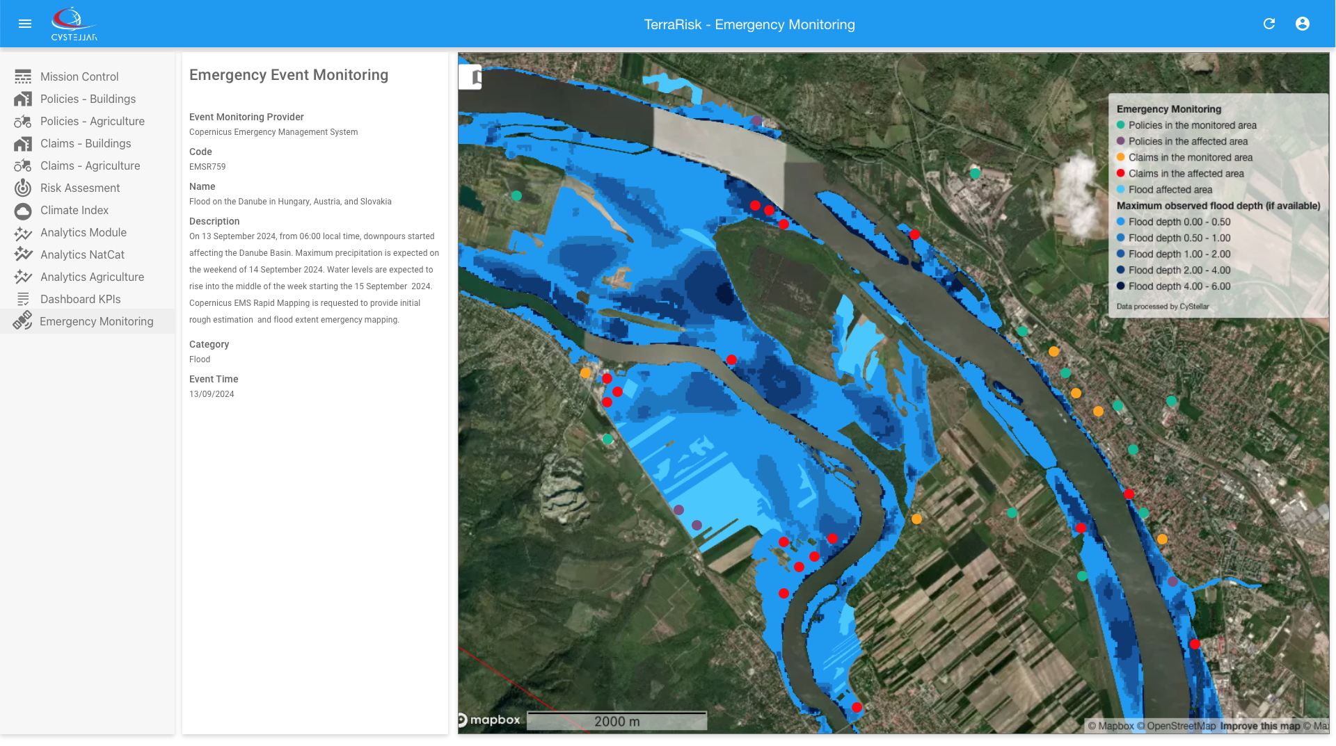
CyStellar TerraRisk Re integrates data from Emergency Monitoring services like the Copernicus Emergency Management Service (CEMS), the European Union's Earth Observation Programme, providing real-time monitoring of natural and man-made disaster. CEMS constantly monitors Europe and the globe, using satellite, in-situ, and model data to detect impending disasters or evidence of an ongoing event. By integrating this comprehensive data, our service provides a powerful tool for understanding the real-time impact of natural catastrophes.
Eutrophication
Nutrient over-enrichment of water detection, causing algae blooms, oxygen depletion, and ecosystem damage, often driven by runoff from agriculture, sewage, or industrial activities.
Deforestation
Detection of large-scale clearing of forests for agriculture, urban development, or logging, leading to habitat loss, biodiversity decline, soil erosion, and increased carbon emissions.
Land Erosion
Detection of loss of soil due to wind, water, or human activities, that increases risks of property damage, structural instability, and higher claims for landslides or flooding insurance policies.
Land Cover and Land Use
Land cover and land use monitoring by tracking changes in natural surfaces (vegetation, water, soil) and human activities (farming, urban areas).
Land Subsidence
Detection of gradual sinking or sudden collapse of the ground due to natural processes or human activities like groundwater extraction, mining, or soil compaction.
Methane Leakage
Methane leakage detection from space using satellite data to identify and monitor emissions from oil, gas operations, and landfills, aiding in climate change mitigation and emission control strategies.